


Missouri has more than 110,000 miles of running water, which are the product of the land surrounding them. Their watersheds consist of uplands, floodplains, stream corridors, stream channels, and groundwater.
Headwater streams trap sediment and organic material, which slow water velocities; however some organic material is still transported downstream to contribute to stream habitat. As headwater streams converge, enlarge, and move down through floodplains, they often change in flow from ephemeral to intermittent and eventually into larger perennial streams, which flow year-round due to their connection with groundwater.
Rivers and streams differ from other types of freshwater aquatic habitats by the movement of their water. Limnologists are scientists who study lakes and other freshwater ecosystems, just as oceanographers study saltwater ecosystems. They often distinguish between lentic (standing) water and lotic (running) water. Rivers and streams are the latter.
Streams, including rivers and creeks, connect the land to other bodies of water (such as lakes and oceans) like blood vessels connect the parts of the body. Nutrients, silt, minerals, pollutants, and much more are swept into rivers and streams as rainwater runoff; streams ultimately carry these materials from the land into lakes and oceans via streams and rivers.
What’s in a Name?
What’s the difference between streams, rivers, creeks, brooks, branches, and forks? “Stream” refers to any kind of linear body of flowing water. But place-names often do not obey any official ecological designations (even if people could agree on what those are), so the names are relative. Rivers are large and are fed by smaller streams; branches and forks are the main tributaries of rivers; creeks and brooks are the smallest streams that feed into a river system.
Streams Vary by Region
Just as in terrestrial (land) communities, different types of aquatic communities are not distributed evenly across the state. The Ozarks, in roughly the southern half of the state, are typically rugged, rocky, and forested, while the prairies in the northern and western sections are dominated by flat or rolling grasslands (and croplands), often with deep soils. In southeastern Missouri, the flat Bootheel lowlands were historically dominated by swamps.
So it shouldn’t be surprising that, with the rocks, soils, terrain, vegetation, and water-flow patterns varying in each region, our creeks and rivers, plus the ponds, lakes, reservoirs, and wetlands, should also vary by region.
Biologists who study aquatic organisms have developed a system for describing Missouri’s aquatic habitat regions, as they relate to the aquatic animals (fauna) of an area. These are called Aquatic Faunal Regions, and Missouri has four.
River and Stream Aquatic Faunal Regions
Missouri’s four Aquatic Faunal Regions give us a shorthand for describing the characteristics of the rivers and streams (and other aquatic habitats) where fish, crayfish, and other aquatic animals live. To understand the lives of our various aquatic animals, you should know about our four Aquatic Faunal Regions: Grassland/Prairie, Ozark, Mississippi Lowland, and Big River.
1. Grassland/Prairie Streams
The Prairie Aquatic Faunal Region includes most of the state north of the Missouri River, plus a wedge-shaped area south of the Missouri along the Kansas state line. This region is mostly flat or rolling plains. The area north of the Missouri River was flattened by glaciers long ago; the prairies south of the river were not glaciated.
The streams in the grassland/prairie region are typically very sinuous (S-shaped), with low gradients and fine substrates.
Shales and thin sandstones are the principal bedrocks, but these can be covered by as much as 150 feet by loess soils (loess is a silt-grained material blown by winds during glacier times and which collected, like dunes, in certain areas).
Missouri’s prairie regions, today, are dominated by cropland, but before settlers arrived and broke the sod with their plows, these lands were covered by treeless tallgrass prairie, with woods in the more hilly areas. Those native grasslands and forests are nearly all gone.
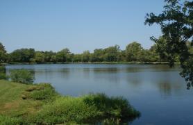
The Prairie Aquatic Faunal Region is drained by a number of rivers. These typically occupy broad, flat valleys that slope gradually into the surrounding uplands. Originally, most of these low-gradient streams meandered in S-shaped courses and often formed oxbow lakes and sloughs as they shifted their beds. Most of these streams, however, have been channelized and are now straight with a nearly uniform depth.
The stream bottoms in the Prairie Region are typically made of fine substrates (silt, sand, or gravel), and the water is generally turbid (not clear), due to clay and soil particles suspended in the water. Stream flow and other water conditions can vary over the course of a year, so the animals that live in these streams must be able to tolerate fluctuations of current, depth, dissolved oxygen levels, temperatures, and so on.
Major prairie rivers include
- The Des Moines, Fox, Wyaconda, Fabius, North, South, Salt, and Cuivre rivers (draining into the Mississippi)
- The Chariton, Grand, Platte, Nodaway, Tarkio, and Nishnabotna rivers (draining southward into the Missouri)
- From Boone County and east, several short, direct tributaries drain southward into the Missouri River
- South of the Missouri River, the Prairie region is drained by the Osage River, the Blackwater and Lamine rivers, and portions the North Fork of Spring River.
While many of the plants and animals living in prairie streams are widespread generalists that can survive in a variety of conditions, others are specialists that can live only in certain prairie or transitional habitats.
2. Ozark Streams
In Missouri, the Ozark highlands occur mostly south of the Missouri River. To the east, they end where the Bootheel lowlands begin, and to the west, they transform gradually into the Prairie Faunal Region, showing a blend of characteristics along a line drawn roughly from Morgan through Jasper counties.
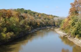
The streams in the Ozark region typically have steeper gradients than those in the north and have coarse, rocky substrates.
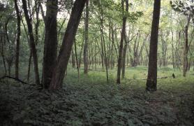
Geologically, the Ozarks are an elevated plain of ancient bedrock, through which streams have carved deep channels, creating a complex system of rugged hills, rock outcrops and bluffs, and thin, stony soils. Much of the land is forested, and the primary agricultural use is pasture.
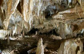
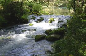
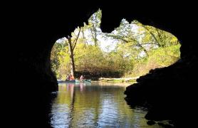
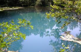
The limestone and dolomite karst geology in the Ozarks is famous for its caves and springs, and these influence the character of Ozark streams. Ozark streams typically occupy narrow, steep-sided valleys and often amount to a series of short pools connected by well-defined riffles. Ozark streams usually have coarse, rocky substrates and steeper gradients than those in our prairie regions. Chert gravel is often at the bottom of the stream bed. Ozark streams are typically clear and relatively cool, often because they are fed by springs.
The aquatic animals that live in these clear, cool, high-gradient, fast-flowing, chert-bottomed streams are particularly diverse, because the many separate stream systems are generally isolated from each other. Thus a fish or crayfish species that lives in one stream may not occur at all in a separate stream only a few miles away — as the crow flies — because they cannot travel overland to reach that different stream system.
In addition to its famous streams and springs, the Ozark Aquatic Faunal Region also contains some large reservoirs created when certain rivers were dammed. The Lake of the Ozarks and Table Rock Lake are examples. These large lakes have their own habitat conditions quite different from Ozark streams. The reservoirs and dams affect the rivers upstream and downstream from them, and their dams prevent aquatic animals from moving past them, particularly upstream.
The following major rivers and their systems of tributary streams are prime examples of the Ozark Aquatic Faunal Region.
- The Osage and Gasconade rivers (which flow into the Missouri River),
- The Meramec and St. Francis rivers (and others that flow into the Mississippi),
- The James and North Fork rivers (which flow into the White River),
- The Black River system (including the Eleven Point and Current rivers), and
- The Elk and Spring rivers (which flow into the Neosho River).
The rather fast-flowing, clear, cool waters of Ozark streams, their substrates, and their water chemistry are home to many plants and animals not usually found elsewhere in the state.
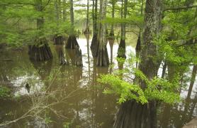
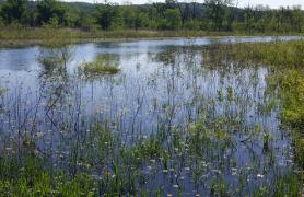
3. Mississippi Lowland Streams
Missouri’s Lowland Aquatic Faunal Region lies mostly in the seven counties in or near the Bootheel. There’s an abrupt change of elevation — anywhere from 50 to 250 feet — as you travel south or east from the Ozark Plateau into that section. Much of the lowlands are not much higher than the Mississippi River itself, being less than 300 feet above sea level.
Streams in the Mississippi lowlands are very flat and have sandy, alluvial (river-deposited) substrates.
Historically, this area was nearly always flooded by Mississippi River backwaters and covered with swamps wooded with bald cypress trees, but starting in about 1900, people cleared the forests and constructed channels and ditches to drain the wetlands. Not much is left of the Bootheel’s presettlement landscape. Vast, sunny fields of cotton and other row crops now dominate the Bootheel.
What remains of the plants and animals that are native to that area are now confined to drainage ditches of various sizes, plus Mingo Swamp, Otter Slough, and other publicly owned nature preserves. Many of these plants and animals are found only in the Bootheel and nowhere else in the state.
The lower St. Francis, Black, and Little Black rivers are the principal, essentially natural streams left in this region. Water clarity is low to moderate, substrates are silty, occasionally with small gravel. There are few riffles, and the usually tree-lined stream channels consist mostly of pools with little or no current.
The ditches vary widely in size, flow, clarity, substrate, and vegetation. Major ditches amount to small rivers, with uniform depth, considerable current, and little vegetative cover. Smaller ditches can have a swift current, often with sand or small gravel substrate, or little current at all, often with silt and organic debris at the bottom. Smaller ditches can have abundant submerged aquatic vegetation.
What remains of the unique swampy ecosystems of the Bootheel, and the plants and animals that now live in the remaining streams, drainage ditches, and canals, are often quite distinct from their relatives that live in rest of our state.
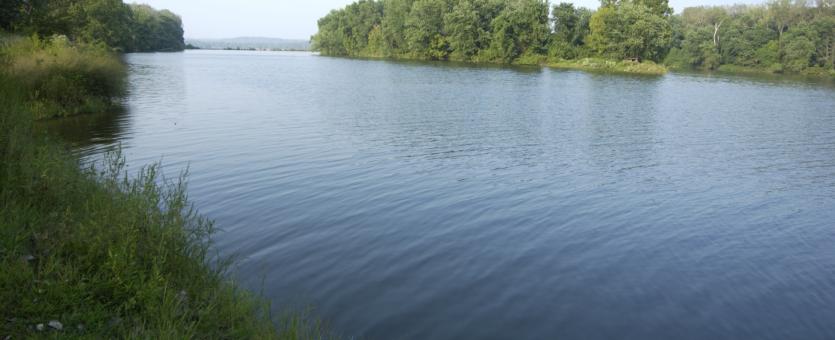
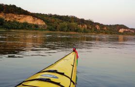
4. Big Rivers: The Missouri and Mississippi Rivers
Our two biggest rivers, the Missouri and Mississippi, are so different from our other aquatic habitats that they constitute their own aquatic faunal region. The water conditions of these rivers are less influenced by local conditions than by the rainfall and runoff from all the land they drain — indeed, much of the United States.
Since they have been channelized, their flow is swift and constant, and public engineers continually monitor and dredge the channel, to keep it deep enough for barge traffic. Although dams upstream have reduced the river’s turbidity, it’s still appropriate to call the Missouri “the big muddy.” The channel bottom of these rivers is covered by shifting sand, gravel, and silt. Animals living in the Missouri and the Mississippi must withstand the strong current and turbidity.
Channels and levees have eliminated much of the wetland habitat that used to occur along the river bottoms, but after catastrophic floods in recent decades, people have been more receptive to the idea of establishing wetland buffer zones to absorb floodwaters.
Oxbows, backwaters, and the mouths of tributary creeks and rivers are connected to big rivers. In the upper Mississippi, navigation pools are created by locks and dams. These associated, but very different, calmer places are where many big river species retreat seasonally, and where many other species live their lives.
The swift currents, unstable substrates, and deep, turbid, murky water create a challenging environment for plants and animals.
Note that organisms are not evenly distributed throughout the Missouri and Mississippi. For example, although some fishes are found throughout both rivers, others occur only in certain sections. Some typical distribution patterns include:
- Present in the Missouri River and the Mississippi River south of the confluence, but not in the Mississippi north of the confluence
- Present in the Mississippi River, but rare in the Missouri
- Present in the Mississippi River only downstream of the mouth of the Ohio River.


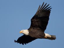
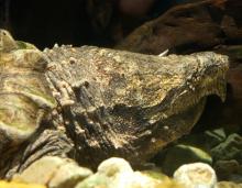
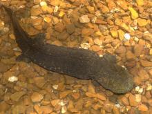
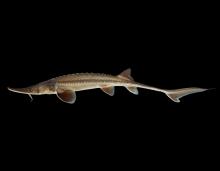
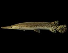
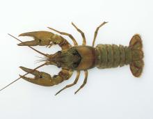
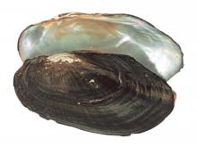
Key species
Related Habitats
Ozark Streams
Grassland and Prairie Streams
Mississippi Lowland Streams
Big Rivers
Lakes, Ponds, and Reservoirs
Wetlands
Bottomland Forests
Aquatic Caves
Springs
Caves and Karst