


Our Big Rivers: The Missouri and The Mississippi
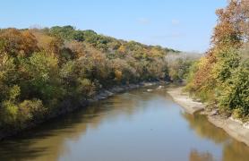
The Missouri River forms the northern part of our state’s western border, then crosses west-to-east through the center of the state to join the Mississippi at St. Louis. Between its headwaters in Montana and its confluence with the Mississippi at St. Louis, it is 2,341 miles long — the longest river on the continent. It drains more than 500,000 square miles, including all or parts of 10 states and 2 provinces — about one-sixth of the United States.
By the time it reaches our state, the Missouri has gained the flow of many tributary rivers and has passed through several dams and reservoirs. When it joins the Mississippi, it contributes nearly half of the water that flows downstream past their confluence.
Before it was channelized and controlled by dams and reservoirs, the Missouri used to rise a great deal in spring, as winter snow melted in the Great Plains, and again in June, as rains came and snow melted in the Rocky Mountains.
The Missouri was nicknamed the Big Muddy before there were channels, dams, and reservoirs, back when it carried huge amounts of sediment — hundreds of millions of tons per year. Today, the amount is “only” 20 to 25 million tons, as the river is not allowed to change its course and because dams arrest its flow, making silt fall to the bottom of reservoirs. But it’s still muddy-looking, and the Missouri River contributes more than half the silt that arrives in the Gulf of Mexico, forming the Mississippi Delta, so the Big Muddy nickname is still apt.
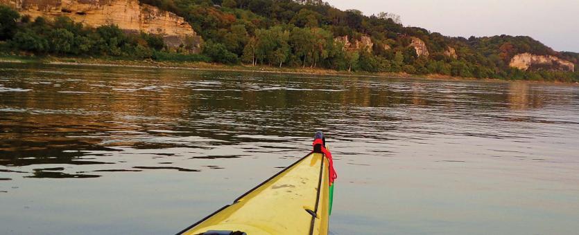
The Mississippi River forms the eastern border of our state. In all, that river is 2,320 miles long, the fourth longest river in the world. Counting its many tributaries, including the Missouri River, it drains all or parts of 31 states and 2 provinces, between the Rockies and the Appalachians, more than 1,245,000 square miles. By discharge, it is the 15th largest river in the world. Until the Louisiana Purchase, the Mississippi River was the western boundary of the United States.
- From its upper reaches in Minnesota to St. Louis, the Upper Mississippi is controlled by locks and dams, channels, and wing dikes. The Upper Mississippi is essentially a series of human-made lakes convenient for river transportation, hydroelectric power, and recreation.
- South of St. Louis, where the Missouri joins it, the Mississippi widens and flows more freely. The section between the confluences of the Missouri and the Ohio rivers is called the Middle Mississippi.
- The portion of the Mississippi that flows south of the confluence with the Ohio — at Cairo, Illinois, and Birds Point, Missouri — is the Lower Mississippi. A thousand miles downstream from this point, the mighty river meets the Gulf of Mexico.
Big River History
Our Big Rivers are tremendously important historically. Before planes, trains, and cars were invented, boats were the fastest way to travel long distances, so rivers were the early highways for Native Americans, explorers, and settlers. Fertile bottomland soils supported abundant plant and animal life and valuable croplands. Thousands of years ago, Native Americans created a prehistoric metropolis, Cahokia, in the confluence region. At its peak, Cahokia was more populous than London, England, was at the same time.
For the same reason, historic cities like Hannibal, St. Louis, Ste. Genevieve, Cape Girardeau, St. Joseph, Kansas City, Lexington, Boonville, Jefferson City, Hermann, and Washington began as river towns, centers of trade and human settlement.
Rivers have strongly influenced human history. Here are some of the ways the Mississippi and Missouri have been important:
- The Missouri River was the highway that led the Lewis and Clark expedition far into the northwest, as they hoped it would eventually lead to the Pacific. (It doesn’t.)
- The Mississippi River is central to some of Mark Twain’s most beloved novels.
- Railroads often run along rivers because of their relatively flat ground and the difficulty of crossing them.
- River bridges are places where highways converge, where traffic increases, where human development occurs, and where cities prosper.
- Building bridges across major rivers has always been an engineering challenge; the Eades Bridge in St. Louis is an example of one city’s effort to retain its economic power.
If streams, including rivers and creeks, connect the land to large bodies of water (such as lakes and oceans) the way blood vessels interconnect the parts of the body, then the Missouri and Mississippi are North America’s major veins. Nutrients, silt, minerals, pollutants, and much more are swept into rivers and streams as rainwater runoff; rivers ultimately carry these materials from the land into lakes and oceans.
The Big Rivers Aquatic Faunal Region
Our Big Rivers — the Missouri and Mississippi — constitute one of four Aquatic Faunal Regions recognized by Missouri biologists who study aquatic organisms. The other three are Grassland/Prairie, Ozark, and Mississippi Lowland.
The four Aquatic Faunal Regions give us a shorthand for describing the characteristics of the aquatic habitats where fish, crayfish, and other aquatic animals live. To understand the lives of aquatic organisms, you must know about their preferred habitats.
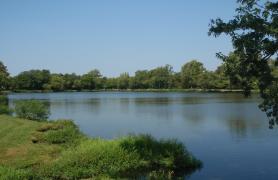
The Missouri and Mississippi rivers are quite different from our other aquatic habitats. The water conditions of these rivers are less influenced by local or regional conditions than by the rainfall and runoff from all the land they drain — indeed, much of the United States.
The Missouri and Mississippi rivers are altered habitats, having been changed drastically from their presettlement forms. Public engineers continually monitor and dredge the channels to keep them deep enough for barge traffic. Although dams upstream have reduced its turbidity (murkiness from suspended mud), the Missouri is still “the big muddy.” The channel bottom of the two rivers is covered by shifting sand, gravel, and silt. Animals living in the Missouri and the Mississippi must withstand the strong current and turbidity.
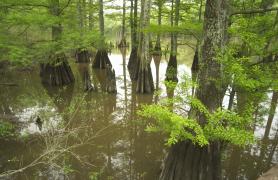
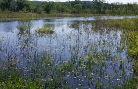
Channels and levees have eliminated much of the wetland habitat that used to occur along the river bottoms, but after catastrophic floods in recent decades, people have been more receptive to the idea of establishing wetland buffer zones to absorb floodwaters.
Oxbows, backwaters, and the mouths of tributary creeks and rivers are connected to big rivers. These very different, calmer places are where many big river species retreat seasonally, and where many other species live their lives.
Historically, the Missouri used to occupy a wide, braided channel with many islands and backwaters. The location of the channel changed with every flood, and bank erosion was continuous. Today, the river is confined to a single, relatively narrow channel by the installation of wing dikes and revetments. Channel shifting and bank erosion have been almost eliminated, and the quiet backwaters are mostly gone. Channelizing the river makes the flow swift and constant. Fine, shifting sand is the main bottom type; in places where the current is strongest, the bottom has small gravel, and in protected areas along the shore, deep deposits of silt line the bottom.
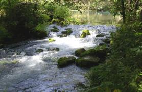
Compared to the Missouri, the Upper Mississippi River (above the confluence with the Missouri) is relatively clear. The Mississippi originally consisted of a series of alternating deep pools and shallow rapids, and it was more placid. Today, a series of navigation pools (6 of which are in the Missouri section of the river) have converted the river into a series of lakes — but areas with considerable current still occur downstream from the dams. The places with the strongest current have sand, gravel, and rock bottoms. The bottoms of the navigation pools are mostly silt, which falls out of the water when the water flow is arrested. In protected areas of the pools, extensive beds of aquatic vegetation occur.
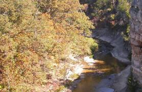
Below the mouth of the Missouri River, the Middle Mississippi takes on much of the character of the Missouri: it has not been dammed, and it has a swift current. The turbidity is high, though it’s not as muddy as the Missouri. Gravelly and rocky bottoms are more prevalent than in the Missouri.
After the Ohio River joins it, the Mississippi changes again. At this point, just south of Cape Girardeau, it becomes the Lower Mississippi. The massive, relatively clear flow of the Ohio causes the Mississippi to be clearer; sand and gravel predominate on the bottom, with silt in the backwaters.
Typical Plants and Animals
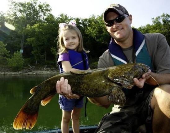
The swift currents, unstable substrates, and deep, turbid, murky water create a challenging environment for plants and animals. Big River fish, for example, are often strong swimmers; catfishes and sturgeons in our Big Rivers rely mostly on their senses of smell and touch, as eyesight is hampered in the deep, muddy water.
Fish that are abundant in both big rivers include shortnose and longnose gar, gizzard shad, common carp, river carpsucker, buffalofishes (3 species), channel catfish, flathead catfish, white bass, and freshwater drum.
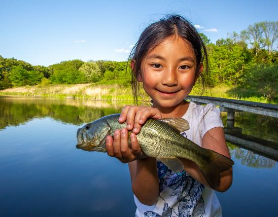
Fish abundant in the oxbows and backwaters associated with the big rivers include largemouth bass, bluegill, and black and white crappies.
Other fish especially characteristic of the big river faunal region are the chestnut lamprey, shovelnose and pallid sturgeons, paddlefish, skipjack herring, goldeye, blue sucker, and blue catfish.
Many small fishes are characteristic of the big river faunal region, too, including the speckled chub, sturgeon chub, sicklefin chub, silver chub, flathed chub, plains minnow, emerald shiner, river shiner, silverband shiner, and channel shiner.
Big-river organisms are not necessarily evenly distributed throughout the Missouri and Mississippi. Although some aquatic animals are found throughout both rivers, others occur only in certain sections. Some typical distribution patterns include:
- Present in the Missouri River and the Mississippi River south of the confluence, but not in the Mississippi north of the confluence. Examples: pallid sturgeon, western silvery minnow, sturgeon, sicklefin, and flathead chubs, and plains minnow.
- Present in the Mississippi River, but rare in or absent from the Missouri. Examples: stonecat and freckled madtoms; and the slenderhead, logperch, river, and western sand darters; Mississippi grass shrimp, Ohio shrimp, threadfin shad, spottail shiner.
- Present in the Mississippi River only downstream of the mouth of the Ohio River. Example: inland silverside.
A hundred years of engineering the big rivers to accommodate barge navigation has changed the kinds of fishes that live in them. Missouri River dams upstream from us reduced turbidity and changed the seasonal flow patterns; as a result, the flathead chub and plains minnow, forage fishes that were very common in the Missouri in 1945, have now nearly disappeared and have been replaced by the emerald shiner and other sight feeders. Changing conditions have also caused the pallid sturgeon to decline, and several fishes formerly abundant in the Upper Missouri to increase in the lower portion of the river.
Engineering of the Mississippi has caused changes in its fish fauna and distribution, too. Sedimentation increases near dams, eliminating backwaters and reducing depths of pools. Dams are also barriers to fish movements. When power plants release heated water into the river, the resulting zones of warmer water can serve as winter refuges for some fish species, allowing them to extend their ranges north. Below the dams, where the river is engineered to by swifter and deeper, and carries less silt, fishes adapted for turbid plains waters decline.
Nonnative and invasive species include common carp, grass carp, bighead carp, silver carp, and black carp — all are Asian species. The common carp was well established by 1895, and today, in terms of total poundage, the Missouri and Mississippi river harvest of common carp exceeds that of any other species in most years, as reported by commercial fishermen. The numbers of grass and bighead carp are growing, and those of silver and black carp are also threatening to become problems. Bighead carp are especially worrisome, as they compete directly with paddlefish, bigmouth buffalo, and the young of many species.


Related Habitats
Bottomland Forests

Grassland and Prairie Streams
Mississippi Lowland Streams
Ozark Streams
Stream Edges
Cliffs

Aquatic Faunal Regions of Missouri
Wetlands
Lakes, Ponds, and Reservoirs